
Marine Institute releases the most advanced and highest resolution geomorphology map of Ireland's seabed
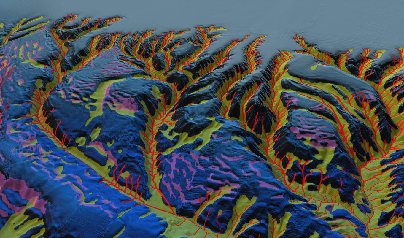
New Irish Deep Water Seabed Geomorphological Map (IDSGM26) expands Ireland’s seabed record, extending coverage from the shoreline to the deep Atlantic, marking a major milestone in ocean science.
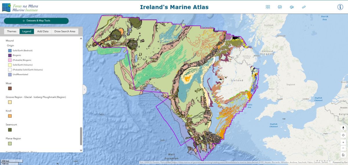
The Marine Institute, with University College Cork, have released the Irish Deep Seabed Geomorphological Map - now available on the Irish Marine Atlas – significantly expanding the high-resolution mapping of the features of Ireland's seabed.
Geomorphology examines the physical features of the Earth's surface and seeks to understand why landscapes look the way they do, how they have evolved over time, and how they may change in the future.
Until now, detailed morphological maps showing the complex characteristics of the deep-water seabed existed only in fragmentary, regional studies with no cohesive public database available. The IDSGM26 brings together results from all previously published deep-water mapping efforts alongside newly interpreted features, applying consistent, internationally standardised classification to produce a single coherent national geomorphology data resource.
“It was amazing to do this analysis and see the big picture for the first time having spent years exploring all the tiny details,” said Professor Andy Wheeler, Head of the UCC Marine Geoscience Research Group.
“This map gives us, for the first time, a comprehensive picture of Ireland's seabed geomorphology, from the coastline to the deepest parts of Ireland’s offshore territory. It is a major scientific achievement and a valuable resource for Ireland’s sustainable development,” said Dr Fabio Sacchetti, Team Lead, Advance Mapping Services, Marine Institute.
Geomorphological maps of this type are essential reference tools for policymakers, marine industries, and scientists.
The map will contribute to the evidence base required for risk management, marine spatial planning, consenting processes, and regulatory compliance monitoring. It will support a wide range of national priorities, including:
- Offshore wind energy and infrastructure development
- Designation and management of Marine Protected Areas (MPAs)
- Protection of sensitive deep-sea habitats, including cold-water coral reefs
- Routing of submarine cables and pipelines
- Monitoring and reporting under the Marine Strategy Framework Directive (MSFD), European marine environmental legislation
All seabed features have been classified using internationally recognised standards, allowing Ireland's mapping to be directly compared with similar datasets worldwide.
A National Undertaking Two Decades in the Making
Deep-water environments are among the ocean's most important and least explored areas, and Ireland's deep Atlantic margin is home to rich cold-water coral mounds and reef systems.
This new release, funded by Marine Institute, was developed in collaboration with the Marine Geoscience Research Group at University College Cork (UCC). It is derived from analysis of data acquired during over 25 years of national government-supported seabed mapping, through the Irish National Seabed Survey and INFOMAR programmes.
The INFOMAR programme is funded by the Department of Climate, Energy and the Environment and is delivered in partnership by Geological Survey Ireland and the Marine Institute. It is due to end in Q4 2029, a key milestone for Ireland in the United Nations Decade of Ocean Science for Sustainable Development.
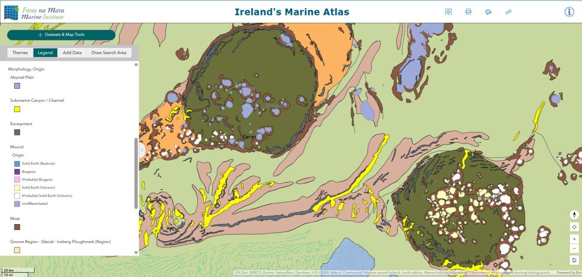
The map builds on the Irish Shelf Seabed Geomorphological Map (ISSGM), released in 2024, which mapped Ireland's continental shelf to depths of 200 metres. The new release extends that work into deeper waters, from 200 m down to approximately 5,000 m, covering submarine canyons, underwater mountains, glacially sculpted troughs, volcanic seamount features, continental slopes and the abyssal plain.
With knowledge built over many years of deep-sea surveys, often using the Marine Institute’s Holland 1 remotely operated vehicle, the UCC Marine Geoscience Research Group in the School of Biological, Earth and Environmental Sciences was well placed to develop the map, drawing on their extensive, first-hand understanding of Ireland’s deep-water territories.
A World First for Ireland
With the publication of the IDSGM26, Ireland now has a continuous, high-resolution record of its seabed landscape stretching from the intertidal zone to the deepest parts of Ireland’s offshore territory.
This achievement helps to retain Ireland’s position at the forefront of international seabed mapping and provides an enduring scientific resource that will support research, conservation and sustainable ocean management for decades to come.
This has been made possible by the national expertise developed in Ireland through the significant commitments and achievements of the Irish National Seabed Survey (INSS) and INFOMAR programmes over the past two decades, an effort that surveyed one of the most geologically complex and ecologically significant margins in the North Atlantic.
Availability
The IDSGM26 data are now freely accessible and integrated into the Irish Marine Atlas (https://atlas.marine.ie) under the Geomorphology theme. The dataset is available for download in Shapefile format and via Web Map Service (WMS). Data are provided under a Creative Commons licence, enabling open use by researchers, industry, policymakers, and the public.
The Irish Marine Atlas, developed and maintained by the Marine Institute with funding from the Department of Housing, Local Government, and Heritage, serves as the national repository for marine environmental data and supports Ireland's reporting obligations under the Marine Strategy Framework Directive.
Authorship and Funding
The IDSGM26 was produced by Dr. Mohit Tunwal and Prof. Andy Wheeler, (Marine Geoscience Group, School of Biological, Earth and Environmental Sciences, University College Cork) and by Dr. Fabio Sacchetti (Advance Mapping Services, Marine institute). This research was carried out with the support of the Marine Institute, funded under the Marine Research Programme by the Government of Ireland (Grant-Aid Agreement No. PDOC/19/08/03).
ENDS
For any media enquiries please contact:
Kathleen Sweeney e: kathleen.sweeney@marine.ie | m: +353 (0)87 094 5754
Sinéad Coyne e: sinead.coyne@marine.ie | m: +353 (0)87 947 7090
Communications Office, Marine Institute e: communications@marine.ie | t: +353 (0)91 387 20
About the Marine Institute
The Marine Institute is Ireland's national agency responsible for marine research, technology development, and innovation. It works to promote the sustainable development and management of Ireland's marine resource through the provision of scientific advice, data, and services.
Selected Key Collaborators and References
Arosio et al. (2024). CoMMa: A GIS geomorphometry toolbox to map and measure confined landforms. Geomorphology, 458, 109227.
Dove et al. (2020). A two-part seabed geomorphology classification scheme (v.2). Part 1: morphology features glossary. NERC Open Research Archive.
Nanson et al. (2023). A two-part seabed geomorphology classification scheme; Part 2: Geomorphology classification framework and glossary (Version 1.0). Zenodo.
Arosio, R. et al. (2023). The geomorphology of Ireland's continental shelf. Journal of Maps, 19(1).